
Up to 7 Inches of Snow Possible in RI Monday Night Into Tuesday - Winter Storm Warning Issued
Monday, February 27, 2023
The National Weather Service has now issued a "Winter Storm Warning" for most of New England starting Monday night.
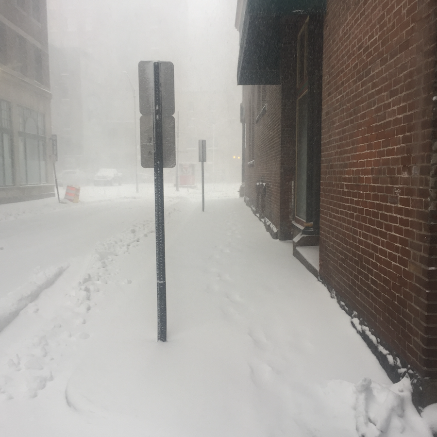
According to NWS -- up to 7 inches of snow is now possible.
Travel is supposed to be hazardous Monday night into Tuesday morning's commute.
GET THE LATEST BREAKING NEWS HERE -- SIGN UP FOR GOLOCAL FREE DAILY EBLAST
Monday
Snow showers are likely, mainly before 9 am. Increasing clouds, with a high near 36. North wind 5 to 7 mph, becoming east in the afternoon. The chance of precipitation is 70%—total daytime snow accumulation of less than a half inch possible.
Tonight
Snow, mainly after midnight. The snow could be heavy at times. Low around 28. Northeast wind 5 to 7 mph. The chance of precipitation is 90%—new snow accumulation of 3 to 5 inches is possible.
Tuesday
Snow, possibly mixed with rain before 3 pm, then a chance of rain between 3 pm and 5 pm, then a chance of rain and snow after 5 pm. High near 37. Northeast wind 6 to 9 mph, with gusts as high as 22 mph. The chance of precipitation is 80%—new snow accumulation of 1 to 2 inches is possible.
Tuesday Night
A chance of snow before 10 pm, then a slight chance of rain between 10 pm and midnight. Cloudy, then gradually becoming partly cloudy, with a low of around 28. Northwest wind 5 to 7 mph. The chance of precipitation is 30%. Little or no snow accumulation is expected.
Wednesday
Mostly sunny, with a high near 46. Northwest wind 6 to 8 mph becoming southeast in the afternoon.
Wednesday Night
A chance of rain, mainly after 8pm. Mostly cloudy, with a low of around 34. South wind 6 to 8 mph. The chance of precipitation is 40%.
Thursday
A chance of rain. Mostly cloudy, with a high near 51. South wind 7 to 15 mph, becoming northwest in the afternoon. The chance of precipitation is 50%.
Thursday Night
Mostly cloudy, with a low of around 30. Northwest wind 11 to 15 mph.
Friday
A chance of snow before 9 am, then a chance of rain and snow between 9 am and 11 am, then rain after 11 am, high near 40. North wind 10 to 13 mph, becoming northeast in the afternoon. The chance of precipitation is 80%.
Friday Night
Rain, possibly mixed with snow, mainly before 4am. Low around 29. Blustery, with a northeast wind of 16 to 23 mph, with gusts as high as 34 mph. The chance of precipitation is 80%.
Saturday
A chance of snow. Partly sunny, with a high near 36. Breezy, with a north wind 14 to 20 mph, with gusts as high as 30 mph. Chance of precipitation is 40%.
Saturday Night
Mostly cloudy, with a low around 23. North wind 8 to 11 mph.
Sunday
Partly sunny, with a high near 39. North wind 9 to 11 mph.
Winter Storm Warning
URGENT - WINTER WEATHER MESSAGE
National Weather Service Boston/Norton MA
317 AM EST Mon Feb 27 2023
CTZ002>004-MAZ003-004-010>012-026-RIZ001>004-006-272130-
/O.UPG.KBOX.WW.Y.0010.230228T0000Z-230301T0000Z/
/O.NEW.KBOX.WS.W.0002.230228T0000Z-230301T0000Z/
Hartford CT-Tolland CT-Windham CT-Eastern Franklin MA-
Northern Worcester MA-Eastern Hampshire MA-Eastern Hampden MA-
Southern Worcester MA-Northern Middlesex MA-
Northwest Providence RI-Southeast Providence RI-Western Kent RI-
Eastern Kent RI-Washington RI-
Including the cities of Hartford, Windsor Locks, Union, Vernon,
Putnam, Willimantic, Greenfield, Orange, Barre, Fitchburg,
Amherst, Northampton, Springfield, Milford, Worcester, Ayer,
Foster, Smithfield, Providence, Coventry, West Greenwich,
East Greenwich, Warwick, West Warwick, Narragansett, and Westerly
317 AM EST Mon Feb 27 2023
...WINTER STORM WARNING IN EFFECT FROM 7 PM THIS EVENING TO 7 PM
EST TUESDAY...
* WHAT...Heavy snow expected. Total snow accumulations of 4 to 7
inches.
* WHERE...Portions of northern Connecticut, central, eastern and
western Massachusetts and northern and southern Rhode Island.
* WHEN...From 7 PM this evening to 7 PM EST Tuesday.
* IMPACTS...Travel will be very difficult Monday night. The
hazardous conditions will impact the Tuesday morning commute.
Rising temperatures and lighter snow will result in road
conditions slowly improving Tuesday afternoon.
* ADDITIONAL DETAILS...Snow overspreads Connecticut and western-
central Massachusetts between 7 pm and 10 pm, then 10 pm to 1 am
across Rhode Island. The heaviest snow and lowest visibility
occurs from late Monday evening into the overnight. Snow
continues to accumulate Tuesday, but at a lighter intensity.
PRECAUTIONARY/PREPAREDNESS ACTIONS...
If you must travel, keep an extra flashlight, food, and water in
your vehicle in case of an emergency.
\
