Good Saturday Morning…
The arctic cold front came through yesterday and will reinforce dangerous cold now through daybreak Wednesday. Isolated power outages are still possible
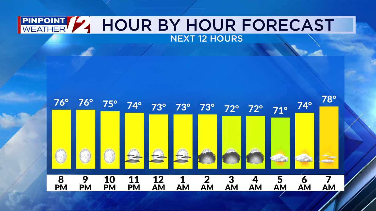
Hour by Hour // A close look at the upcoming conditions »
The core of the cold will occur now through early Saturday morning. Winds chills will plummet to 20 to 30 degrees BELOW ZERO during the pre-dawn hours of Saturday A “Wind Chill Warning” is in effect now through 10 AM Saturday. Take precautions to stay safe in the cold.

Warming centers, shelters open due to frigid conditions »
Frigid air will continue into Saturday but the gusty winds will diminish by afternoon.


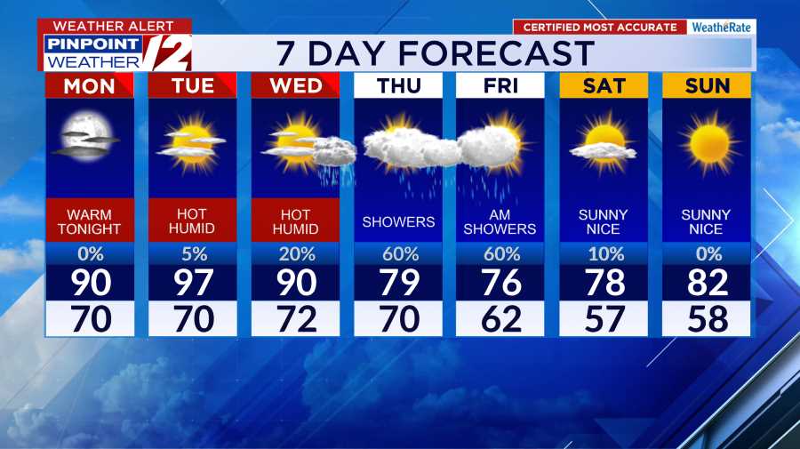
A huge “temperature rebound” will occur by Sunday afternoon as temperatures rise into
the 40s. In fact the 40+ degree temperatures will extend through most of next week. BOTTOM LINE: This frigid air mass will be intense, but brief (2 days).

❄️Ski Report // New England forecast and resort conditions »
GALE WARNING AND “FREEZING SPRAY” ADVISORY
A Freezing Spray Warning. has been issued for the bays and offshore now through Saturday. A rapid accumulation of ice on vessels and boats is possible. Ferry service has also been canceled.

Pinpoint Weather 12 Links
Detailed 7-Day Forecast | Weather Now | Radar | Hour-by-Hour | Ski Report | Ocean & Bay | Solar Report | Pinpoint Traffic | Flight Tracker | Active Weather Alerts | Closings & Delays | Power Outages | Get the Weather App