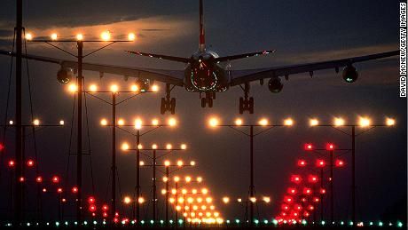
The FAA has issued its list of 50 airports that will be protected from Verizon and AT&T’s 5G signals for six months and the criteria it used suggests the list would have been a lot longer if the FAA had its way. The list was released Friday, a few days after the telecoms agreed to push back their major rollout of 5G cell service from Jan. 5 to Jan. 19 and to put buffer zones around a maximum of 50 airports picked by the FAA until next July 19.
The FAA said it chose the sites based not only on location and traffic, the agency also considered the likelihood of low visibility as a qualifying factor. Some of the country’s largest airports, like Atlanta Hartsfield, didn’t make the cut but some regional facilities like Fresno-Yosemite in California and Harrisburg, Pennsylvania did. Boeing Field in Seattle isn’t served by any major airline but it’s also on the list. The FAA is gambling that it can avoid major disruptions in the system while it works on a final solution to mitigate the potential interference of 5G with radar altimeters. T-Mobile hasn’t been asked to change its system because it doesn’t use frequencies that can interfere with aircraft avionics.




















None of the articles i have read about the 5G possible interference have mentioned the fact that EGPWS systems rely on radar altimeters too. Wouldn’t the loss of rad alt shut down the EGPWS on board an aircraft? Corporate jets (acft with 9 or more seats) flying into mountainous airports would lose one of their most effective warning systems.
EGPWS is but one system of many that are potentially affected by radar altimeter data. Others include TCAS (won’t give a ‘descend’ command near the ground) and windshear weather radar detection systems. Not to mention configuration warning systems such as the landing gear and other important things, up to and including fly-by-wire control laws in some jets.
I was able to confirm with my DO that since we don’t do cat II or cat III ILS approaches in the jets we operate, our company will not be operationally affected by this 5G issue. Cat I ILS does not use radar altimeter to determine decision height. In fact once passing glide slope intercept the EGPWS goes into an approach mode to prevent false alarms during descent on glide slope. The TAWS that most turbine planes have now has its own independent database to determine terrain issues.
It’s interesting how few military bases (zero) are on the list. I’d expect some of the bases where winter and spring fogs are as impenetrable as the famously ugly London fogs would have made that cut. Bases like FAFB in Washington is infamous for absolutely awful visibilities. It, like other bases that come to mind, is nestled between mountains to the east, south east north and north west is a critical asset for the projection of US air power. It’s comforting to realize how big telecom’s ability to sell faster game speeds for cell phone addicted teens and 20 somethings is more important than national defense and safety of flight for aircraft.
Military bases probably don’t have 5G towers on base. Also, most of those are relatively remote. So far (at first) 5G is a “big city” problem.
Many I suppose, Whidbey NAS main airport is close to towns and PAE.
Good point about airports away from high demand for cellular bandwidth.
(Several years ago there was another spectrum bunfight over interference of some morphing wireless comm outfit with ILS. Mingling of result of transmissions combining with commercial radio stations onto a third frequency is an example of complexity of the subject. Some European countries had already allowed high powered commercial radio stations too close to airports, LAAS is one solution for aircraft precision approach but requires added equipment onboard not just broadcast of WAAS corrections via satellites that newer GPS receivers can handle.
Perhaps FAA only addresses airports with civilian operations.
Some freight carriers do land at military airports.
Many military aircraft do not use ILS, tower talks pilots down via precision approach radar. They way controllers talk it is quite accurate, more so than earlier in Canada which had it on several civilian airports in the 1970s. Controllers tell pilots how far off of desired path they are and which direction.
You’re dating yourself, Keith… Waiting for the list of military airports where in 2022 “many military aircraft” still shoot GCA’s. I believe the military has now also discovered the GPS thing?
Where is FAFB?
There’s one in South Africa.
There is a Fairchild AFB near Spokane, FAA ID KSKA, has ILS (CAT II on 05), Tacan, GPS RNAV approaches (nearby civilian airport is KGEG).
(KBFI is beside a long hill immediately to the east, and hills to the southwest and north.)
So, so right You’re Mr. John T.
Unusual that ATL was left off this list – the busiest airport?! Wx at BHM and ATL is very similar, the two are only a little over 100nm apart, and at the same latitude, but ATL has about 50 times the traffic. I can only believe that there is a plan – to see how many delays/diversions will be caused by 5g operations close to the busiest airport…….
Objection! conspiracy theory alert.
Observe claim that FAA was talked out of some airports.
Have you checked whether or not the airports you lists have ILS certified for CATIII?
This is serious, with 50 foot DH wheels will touch the ground during go-around,
https://en.wikipedia.org/wiki/Instrument_landing_system#ILS_categories
Airlines may choose not to use CATIII minima as there is a cost in airplane equipment and crew training. Ground equipment of course very expensive.
Do you do a conspiracy theory about weather before taking off?
Someone in the article commented on why FAT is protected and ATL is not. I can’t guess why ATL is off the list (bizarre!), but maybe because FAT has a wing of the Calif ANG based there qualifies it. Maybe. These are head-scratchers.
FAT has long lasting extremely low visibility morning fog on most winter mornings into the afternoon. Seems like a qualifier to me regardless of ANG presence.
Thankyou for presenting a FACT.
SEA and YVR have bad Novembers some years with ground fog.
SEA is notable for ravines each end of the main runway, drive from Burien area to H99 and you’ll go under framework holding something to help landing at north end, go west off H99 south of the runway and you’ll get close enough to see that the runway has a dropoff. (There was a restaurant there, perhaps a golf course, long time ago I was there.)
The thoughts so far make sense. I wonder, though, if the lack of listed military bases indicates those are classified from we normal people. I also think there are bases that might have a genuine need for 5G. Nellis? Miramar? Tinker? Et al? Speculation only on my part. YMMV.
See my earlier post.
Phoenix is protected, but Anchorage isn’t? What kind of bizzaro world has 5G created?