Landscapes and Landforms of Terrestrial and Marine Areas: A Way Forward


1
Department of Chemical and Geological Sciences, University of Modena and Reggio Emilia, Via Campi 103, 41125 Modena, Italy
2
National Research Council, Institute of Marine Sciences, Via Gobetti 101, 40129 Bologna, Italy
3
Department of Earth and Environmental Sciences, University of Milano Bicocca, Piazza della Scienza 1 e 4, 20126 Milano, Italy
*
Author to whom correspondence should be addressed.
Water 2021, 13(9), 1201; https://doi.org/10.3390/w13091201
Submission received: 8 April 2021
/
Accepted: 21 April 2021
/
Published: 26 April 2021
(This article belongs to the Special Issue Landscapes and Landforms of Terrestrial and Marine Areas)
1. Introduction
In the last decade, the interest to jointly analyze landscapes and landforms of emerged and submerged areas has been expanding [1]. A major contribution in this direction has been provided by technological improvements and the development of innovative methods for collecting and analyzing geospatial data in the so-called “white ribbon.” A key advance has undoubtedly been the innovation in robotics, remote sensing, and computer vision technologies that have fostered the ability to easily construct high-resolution and even photorealistic terrain models as a base surface for 3D mapping in the underwater environment [2].
Different fields of geosciences have recently benefited from integrating land-and-sea spatial datasets (cf. [1]), mainly as a result of the following:
- An improved understanding of coastal and marine landforms and processes generating them;
- A more efficient assessment of risks and impacts in coastal and nearshore areas, in the context of the ongoing climate change and the development of coastal areas;
- The promotion of more sustainable management practices for coastal and marine environments and related resources.
The aim of this Special Issue is to collect contributions that demonstrate how the integration of emerged and submerged datasets is unquestionably beneficial, in a wider perspective, for geoenvironmental research.
2. Investigating Terrestrial and Marine Landscapes
Investigating terrestrial and marine landscapes as a continuum began to be applied mostly in geomorphological research concerning ocean volcanic islands—in order to investigate the effects of volcanic eruptions on volcanic apparatus (i.e., landslides and collapses; e.g., [3])—or in marine geohazard assessment referring to large coastal landslides (e.g., Nice landslide; [4]).
Recently, studies on coastal geohazards induced by global and climate changes lato sensu took advantage of coupling terrestrial and marine spatial datasets (e.g., elevation data) in order to model and quantify impacts due to, for example, coastal subsidence, sea-level rise, and extreme weather events (i.e., storms), in terms of vulnerability and risk scenarios [5,6,7,8,9,10].
Curiosity and attention on this approach spread also toward other scopes. Both the reconstruction of Late Quaternary geomorphological evolution and the geoarchaeological research in coastal area have highly been favored by the combination of onshore and offshore datasets [11,12]. Indeed, the continental shelves have undergone several sea-level oscillations, and recorded a sea-level fall at ca. 130 m below the present msl during the Last Glacial Maximum (LGM). Thus, large portions of the present continental shelves were exposed to subaerial processes that shaped landforms lying on the seafloor nowadays. These areas possibly hosted prehistoric and historic human settlements—as witnessed by archaeological remains, pollens, bones, or other remains in the sediments, caves, and so forth—which can be discovered and investigated in support of paleo-environmental reconstructions.
Furthermore, merging data from coastal and nearshore areas helped the identification of geodiversity and geosites and the study of marine and landscape ecology considering their connectivity across the coastline. This makes coastal environmental management practices more effective and capable of addressing complex problems, especially in the present context of climate change and sea-level rise. A coordinated plan for the management of terrestrial and marine areas, such as the Protocol on Integrated Coastal Zone Management, is indeed fundamental to preserve and manage coastal environmental resources and ecosystems [13,14].
All these themes can be faced in different ways, and the combined knowledge of terrestrial and submerged landscapes can shed light on cases of geomorphological equifinality between land and sea features.
Finally, the ever-growing scientific and industrial interest in integrating land-and-sea datasets is strongly promoting technological advances and new approaches to picture/depict/represent land- and seascapes in a single view (cf. [15]). Prampolini et al. [1] draw the state of the art of the methods and remote sensing technologies that underpin the current ability to produce seamless digital elevation models (DEMs) and/or digital terrain models (DTMs) for coastal areas, with a comparison of their convenience, limitations, and costs, including some new promising techniques (e.g., structure from motion (SfM) and satellite-derived bathymetry (SDB)).
3. The Special Issue
The papers of this volume deal with two main themes, which fully reflect the initial aim and purposes of the Special Issue:
- Terrestrial and marine landforms in nearshore areas, coupling terrestrial and marine datasets for geomorphological reconstruction, hazard assessment, benthic habitat mapping, environmental conservation, coastal management, and marine spatial planning.
- Landscapes and landforms of recently submerged areas (e.g., during the post-LGM marine transgression) and comparison with present terrestrial areas.
The articles focus on Late Quaternary landscape evolution, geohazards, geomorphological mapping, geoarchaeology, geoheritage, and geodiversity and marine benthic habitat mapping (cf. Table 1). Furthermore, a review paper [1] is included, showing the reasons why the integration of terrestrial and marine datasets would be desirable in geoenvironmental research. Prampolini et al. [1] outline the fields of geosciences that have mostly benefitted from land-and-sea dataset integration, showing the topic breakdown of the large number of scientific papers analyzed. The most explored topic is geohazards (34.5% of the papers), followed by geoarchaeology (16.2%), coastal planning and management (15.5%), Late Quaternary changes of coastal landscapes (9.9%), geomorphological mapping (8.45%), marine and landscape ecology (8.45%), and geoheritage and geodiversity (7.0%).
Most of the papers included in this volume deal with landscapes and landforms of the Mediterranean region. However, a case study from coastal areas of the Indian Ocean is also included [16]. Special Issue contributions took into consideration both the present sea level, its past oscillations, and possible future variations in terms of sea-level rise.
Vulnerability of coastal areas was also faced under different points of view, taking into account climate change extreme events, such as storms causing boulder displacement. The majority of the research carried out took advantage of surveying, modeling, mapping, and analyzing different types of data (e.g., acoustic data and seabed samples for analyzing sediments and deposits) (Figure 1).
3.1. Topic 1: Terrestrial and Marine Landforms in Nearshore Areas
The papers concerning the analysis of terrestrial and marine landforms in coastal and shallow water specifically deal with geomorphological mapping and landscape evolution [22,23], geoheritage and geodiversity [18,19], geohazards [16,20,21], and marine and landscape ecology [28].
Guida and Valente [22] studied the geomorphological aspects of onshore and offshore areas of the Cilento coast (Campania, Italy), correlating land and sea landforms in order to outline their evolution. They produced a digital geomorphological map that supported a physical-based modeling of geomorphological evolution.
Hasan et al. [23] mapped and analyzed the morphological features of the river canyons linking the Karin, Novigrad, and Velebit channels (NE Adriatic Sea). The latter are characterized by tufa barriers that had a role in the Holocene flooding dynamics of the canyons and karst basins. The authors outlined the evolution of the karst estuarine seafloor and reported about the flooding of semi-isolated basins due to sea-level rise.
Perotti et al. [18] proposed a GIS qualitative–quantitative methodology (defined as hydro-geodiversity assessment) to assess and evaluate the geodiversity of both superficial and underground water resources in the Sesia Val Grande UNESCO Global Geopark (Italy). They produced a hydro-geodiversity map of the study area, reporting a weighted evaluation of zones distinguished by a remarkable relationship between surface and underground hydrodynamics.
Coratza et al. [19] identified and evaluated geosites located both onshore and offshore the Portofino Natural Park and MPA (Liguria, Italy). Their analysis was meant to recognize the most suitable sites for tourist improvement and fruition, outlining connections between the land and sea systems. Scientific, ecological, cultural, and aesthetic values were considered, as well as site accessibility, services, and economic potential of the geosites identified.
Biolchi et al. [20] monitored the recent displacement of boulders located on the southernmost coast of the Premantura Promontory (Croatia), possibly due to the storm Vaia that occurred in October 2018. The authors carried out aerial and underwater photogrammetric surveys to identify boulders’ movement onshore and submarine landforms associated with boulder detachment from nearshore seafloor. Furthermore, they modeled a wave height that could have been responsible for boulders’ displacement.
Rizzo et al. [21] assessed the coastal vulnerability of the NE coast of the Island of Gozo (Malta), which is characterized by a high economic value due to tourism activity and the presence of natural protected areas (i.e., Natura 2000 sites). The authors propose an overall vulnerability index combining physical exposure and social aspects, and a cost-effective method that can be reliably applied in areas affected by climate- and marine-related processes (namely, coastal erosion, landslides, and sea-level rise).
Meilianda et al. [16] performed a spatial analysis on multisource datasets to investigate barrier islands’ morphological changes along Sumatra Island coasts (Indonesia), as a result of the secondary effects of the seismic activity related to the Sumatra–Andaman subduction and the Great Sumatran Fault system. In particular, the authors documented that the 2004 megatsunami irreversibly changed barrier islands on the investigated stretches of the coast.
Marchese et al. [28] analyzed biogenic landforms (i.e., coralligenous builds-up) and mapped their distribution in coastal waters along the Apulian continental shelf (Italy) through a semiautomated GIS-based methodology relying on geomorphometric techniques. They calculated the area and volume of these mapped bioconstructions, which represent a hotspot of biodiversity for the Mediterranean Sea and a key carbonate producer in temperate water (cf. [29]).
3.2. Topic 2: Landscapes and Landforms of Recently Submerged Areas
The outputs of research on Late Quaternary landscape changes are presented, with different approaches, in a number of papers of this Special Issue. Mattei et al. [17] supported their research by means of archaeological markers; De Gioiosa et al. [24], Deiana et al. [27], and Savini et al. [26] analyzed terrestrial and marine landforms to reconstruct past sea-level oscillations and paleolandscapes; and Novack et al. [25] took advantage of the acoustic characterization of stratigraphic records.
Mattei et al. [17] performed a multidisciplinary investigation of the submerged Roman harbor at Nisida Island (Campi Flegrei, Italy) and set up a multiscale dataset with the goal of reconstructing the coastal and marine geomorphological evolution of the area. They were also able to outline relative sea-level changes in the last 2000 years through a new type of archaeological sea-level marker.
De Gioiosa et al. [24] analyzed LiDAR data, spectral images, and data from onshore surveys and scuba dives, with the aim of depicting land and sea morphologies and reconstructing Late Quaternary environmental changes of the Torre Guaceto Marine Protected Area (Apulia, Italy). The authors inferred climatic phases and related morphogenetic processes, identifying evidence of past sea-level oscillations.
Novack et al. [25] acoustically characterized the Quaternary sedimentary sequence of an alluvial plain of the NE Adriatic Sea that was submerged after the LGM. The paper shows that the sediment grain size is the main factor influencing sound velocity in shallow areas, the overload effect being negligible.
Deiana et al. [27] analyzed a large amount of multisensor data (seismic data, MBES and SSS data, dives, and UAV data) from the continental shelf off San Pietro Island (Sardinia, Italy) to reconstruct the geomorphological evolution of the area during the LGM. The authors outlined the complexity of a variety of coastal paleolandscapes, which also hosted Mesolithic population.
Savini et al. [26] spatially analyzed data on marine terraces both on land and at sea. Geomorphometric analysis on submerged terraces helped to figure out the depth range distribution of submarine terraces and associate their origin and evolution to the geological and structural setting of the Cilento Promontory (Campania, Italy). The work focused on highlighting the importance of submerged terraces formed on an outcropping bedrock (wave-cut or abrasion platforms) to decipher the signal of sea-level changes along the promontory and offshore, and to reconstruct the tectono-geomorphological evolution of the area.
4. Future Perspectives
Significant contributions have been collected in this volume, showing a variety of approaches and techniques used to integrate terrestrial and marine spatial datasets. The listed outcomes not only show how innovative and advanced geomorphological mapping techniques can support a more informed sustainable management of coastal environments, but also pave the way for other studies that rely on an improved efficiency in providing 3D landscape visualization from remote multisource and multiscale data.
The newly available geomorphological mapping tools and techniques are strongly impacting research on remote landscapes and those environments that are challenging to visualize, model, and analyze by means of traditional techniques. High spatial, temporal, and spectral resolution data from planet, moon, asteroid, and comet surfaces in our solar system collected by means of satellites, landers, and rovers are significant examples. Data visualization and processing in planetary geomorphology are indeed similar to those employed for terrestrial and marine data, and the procedure for recognizing landforms and processes that model planet surfaces can be compared with those acting on the Earth. An improved 3D visualization is also the basis for a more efficient modeling of those physical and abiotic processes that feature environmental changes and consequently can critically improve the associated simulation of future scenarios.
Hence, a strong collaboration among scientific communities working in the field of subaerial, submarine and planetary geomorphology is strongly needed to improve our understanding of geomorphic processes and the links between process and form on earth, seafloor, and even planetary surfaces.
Author Contributions
All authors participated equally in the preparation and writing of this editorial. All authors have read and agreed to the published version of the manuscript.
Funding
The study was carried out in the frame of the project “Coastal risk assessment and mapping” funded by the EUR-OPA Major Hazards Agreement of the Council of Europe (2020–2021), Grant Number GA/2021/08 n_689165 (Resp. Unimore Unit: Mauro Soldati).
Institutional Review Board Statement
Not applicable.
Informed Consent Statement
Not applicable.
Data Availability Statement
Data sharing not applicable.
Acknowledgments
This volume is part of the activities of the Working Group on “Submarine Geomorphology” of the International Association of Geomorphologists (IAG) chaired by Aaron Micallef (Malta) and Sebastian Krastel (Germany). We would like to thank the authors of the articles included in the Special Issue for having enthusiastically accepted to submit their manuscripts to this volume and for their kind cooperation during the whole editorial process. We are grateful to May Zheng, section managing editor, for having so professionally and kindly supported us throughout each step of the Special Issue planning and management.
Conflicts of Interest
The authors declare no conflict of interest.
References
- Prampolini, M.; Savini, A.; Foglini, F.; Soldati, M. Seven good reasons for integrating terrestrial and marine spatial datasets in changing environments. Water 2020, 12, 2221. [Google Scholar] [CrossRef]
- Hartley, R.I.; Zisserman, A. Multiple Views Geometry, 2nd ed.; Cambridge University Press: Cambridge, UK, 2003; p. 655. [Google Scholar]
- Moore, J.G.; Normark, W.R.; Holcomb, R.T. Giant Hawaiian landslides. Annu. Rev. Earth Planet. Sci. 1994, 22, 119–144. [Google Scholar] [CrossRef]
- Mulder, T.; Savoye, B.; Syvitki, J.P. Numerical modelling of a mid-sized gravity flow: The 1979 Nice turbidity current (dynamics, processes, sediment budget and seafloor impact). Sedimentology 1997, 44, 305–326. [Google Scholar] [CrossRef]
- Field, C.B.; Barros, V.; Stocker, T.F.; Qin, D.; Dokken, D.J.; Ebi, K.L.; Mastrandrea, M.D.; Mach, K.J.; Plattner, G.-K.; Allen, S.K.; et al. Managing the Risks of Extreme Events and Disasters to Advance Climate Change Adaptation; A Special Report of Working Groups I and II of the Intergovernmental Panel on Climate Change (IPCC); Cambridge University Press: Cambridge, UK, 2012. [Google Scholar]
- Hoegh–Guldberg, O.; Jacob, D.; Taylor, M.; Bindi, M.; Brown, S.; Camilloni, I.; Diedhiou, A.; Djalante, R.; Ebi, K.L.; Engelbrecht, F.; et al. 2018: Impacts of 1.5 °C Global Warming on Natural and Human Systems. In Global Warming of 1.5 °C; Masson-Delmotte, V., Zhai, P., Pörtner, H.-O., Roberts, D., Skea, J., Shukla, P.R., Pirani, A., Moufouma–Okia, W., Péan, C., Pidcock, R., et al., Eds.; An IPCC Special Report on the Impacts of Global Warming of 1.5 °C above Pre–Industrial Levels and Related Global Greenhouse Gas Emission Pathways, in the Context of Strengthening the Global Response to the Threat of Climate Change; Sustainable Development, and Efforts to Eradicate Poverty; Intergovernmental Panel on Climate Change: Geneva, Switzerland, 2018. [Google Scholar]
- Intergovernmental Panel on Climate Change. Summary for Policymakers. In Climate Change and Land: An IPCC Special Report on Climate Change, Desertification, Land Degradation, Sustainable Land Management, Food Security, and Greenhouse Gas Fluxes in Terrestrial Ecosystems; Shukla, P.R., Skea, J., Buendia, E.C., Masson-Delmotte, V., Pörtner, H.-O., Roberts, D.C., Zhai, P., Slade, R., Connors, S., Diemen, R., et al., Eds.; Cambridge University Press: Cambridge, UK, 2019. [Google Scholar]
- UNISDR (United Nations International Strategy for Disaster Reduction). Sendai Framework for Disaster Risk Reduction 2015–2030; The United Nations Office for Disaster Risk Reduction: Geneva, Switzerland, 2015; Available online: https://www.preventionweb.net/files/43291_sendaiframeworkfordrren.pdf (accessed on 7 April 2021).
- European Commission. An. EU Strategy on Adaptation to Climate Change; The European Commission: Brussels, Belgium, 2013; Available online: https://eur-lex.europa.eu/LexUriServ/LexUriServ.do?uri=COM:2013:0216:FIN:EN:PDF (accessed on 7 April 2021).
- Directive 2007/60/EC of the European Parliament and of the Council of 23 October 2007 on the Assessment and Management of Flood Risks. Available online: https://eur-lex.europa.eu/LexUriServ/LexUriServ.do?uri=OJ:L:2007:288:0027:0034:EN:PDF (accessed on 7 April 2021).
- Bailey, G.; Sakellariou, D.; Members of the SPLASHCOS Network. Submerged prehistoric archaeology and landscapes of the continental shelf. Antiq. Proj. Gallery 2012, 86, 10. [Google Scholar]
- Harff, J.; Bailey, G.; Luth, F. Geology and Archaeology: Submerged Landscapes of the Continental Shelf; Geological Society Special Publications 411; Geological Society of London: London, UK, 2016; p. 294. ISBN 978-1-86239-691-3. [Google Scholar]
- Schlacke, S.; Maier, N.; Markus, T. Legal implementation of integrated ocean policies: The EU’s marine strategy framework directive. Int. J. Mar. Coast. Law 2011, 26, 59–90. [Google Scholar] [CrossRef]
- UNEP/MAP/PAP: Protocol on Integrated Coastal Zone Management in the Mediaterranean. Split, Priority Actions Programme. 2008. Available online: http://iczmplatform.org/ (accessed on 7 April 2021).
- Prampolini, M.; Foglini, F.; Biolchi, S.; Devoto, S.; Angelini, S.; Soldati, M. Geomorphological mapping of terrestrial and marine areas, northern Malta and Comino (central Mediterranean Sea). J. Maps 2017, 13, 457–469. [Google Scholar] [CrossRef]
- Meilianda, E.; Lavigne, F.; Pradhan, B.; Wassmer, P.; Darusman, D.; Dohmen-Janssen, M. Barrier Islands Resilience to Extreme Events: Do Earthquake and Tsunami Play a Role? Water 2021, 13, 178. [Google Scholar] [CrossRef]
- Mattei, G.; Troisi, S.; Aucelli, P.; Pappone, G.; Peluso, F.; Stefanile, M. Sensing the Submerged Landscape of Nisida Roman Harbour in the Gulf of Naples from Integrated Measurements on a USV. Water 2018, 10, 1686. [Google Scholar] [CrossRef] [Green Version]
- Perotti, L.; Carraro, G.; Giardino, M.; De Luca, D.A.; Lasagna, M. Geodiversity evaluation and water resources in the Sesia Val Grande UNESCO Geopark (Italy). Water 2019, 11, 2102. [Google Scholar] [CrossRef] [Green Version]
- Coratza, P.; Vandelli, V.; Fiorentini, L.; Paliaga, G.; Faccini, F. Bridging Terrestrial and Marine Geoheritage: Assessing Geosites in Portofino Natural Park (Italy). Water 2019, 11, 2112. [Google Scholar] [CrossRef] [Green Version]
- Biolchi, S.; Denamiel, C.; Devoto, S.; Korbar, T.; Macovaz, V.; Scicchitano, G.; Vilibic, I.; Furlani, S. Impact of the October 2018 Storm Vaia on Coastal Boulders in the Northern Adriatic Sea. Water 2019, 11, 2229. [Google Scholar] [CrossRef] [Green Version]
- Rizzo, A.; Vandelli, V.; Buhagiar, G.; Micallef, A.S.; Soldati, M. Coastal vulnerability assessment along the north-eastern sector of Gozo Island (Malta, Mediterranean Sea). Water 2020, 12, 1405. [Google Scholar] [CrossRef]
- Guida, D.; Valente, A. Terrestrial and marine landforms along the Cilento coastland (southern Italy): A framework for landslide hazard assessment and environmental conservation. Water 2019, 11, 2618. [Google Scholar] [CrossRef] [Green Version]
- Hasan, O.; Miko, S.; Brunović, D.; Papatheodorou, G.; Christodolou, D.; Ilijanić, N.; Geraga, M. Geomorphology of canyon outlets in Zrmanja River estuary and its effect on the Holocene flooding of semi-enclosed basins (Novigrad and Karin Sea, eastern Adriatic). Water 2020, 12, 2807. [Google Scholar] [CrossRef]
- De Giosa, F.; Scardino, G.; Vacchi, M.; Piscitelli, A.; Milella, M.; Ciccolella, A.; Mastronuzzi, G. Geomorphological Signature of Late Pleistocene Sea Level Oscillations in Torre Guaceto Marine Protected Area (Adriatic Sea, SE Italy). Water 2019, 11, 2409. [Google Scholar] [CrossRef] [Green Version]
- Novak, A.; Šmuc, A.; Pogljen, S.; Celarc, B.; Vrabec, M. Sound velocity in a thin shallowly submerged terrestrial-marine Quaternary succession (northern Adriatic Sea). Water 2020, 12, 560. [Google Scholar] [CrossRef] [Green Version]
- Savini, A.; Bracchi, V.A.; Cammarosano, A.; Pennetta, M.; Russo, F. Terraced Landforms Onshore and Offshore the Cilento Promontory (South-Eastern Tyrrhenian Margin) and their Significance as Quaternary Records of Sea Level Changes. Water 2021, 13, 566. [Google Scholar] [CrossRef]
- Deiana, G.; Lecca, L.; Melis, R.T.; Soldati, M.; Demurtas, V.; Orrù, P.E. Submarine Geomorphology of the Southwestern Sardinian Continental Shelf (Mediterranean Sea): Insights into the Last Glacial Maximum Sea-Level Changes and Related Environments. Water 2021, 13, 155. [Google Scholar] [CrossRef]
- Marchese, F.; Bracchi, V.A.; Lisi, G.; Basso, D.; Corselli, C.; Savini, A. Assessing fine-scale distribution and volume of Mediterranean algal reefs through terrain analysis of multibeam bathymetric data. A case study in the southern Adriatic continental shelf. Water 2020, 12, 157. [Google Scholar] [CrossRef] [Green Version]
- Basso, D.; Granier, B. Calcareous algae in changing environments. Geodiversitas 2012, 34, 5–11. [Google Scholar] [CrossRef]
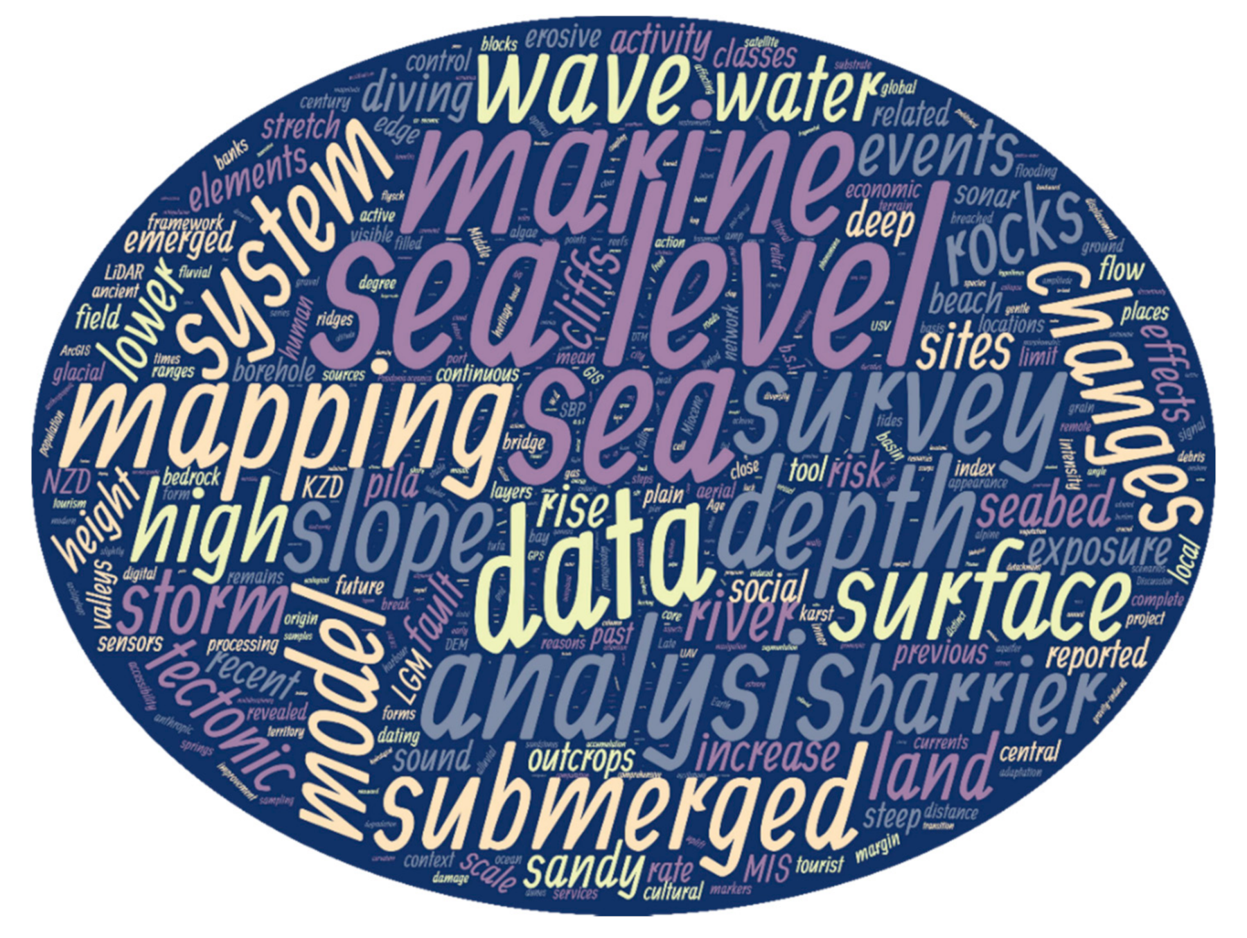
Figure 1.
Word cloud of the Special Issue “Landscapes and Landforms of Terrestrial and Marine Areas” providing a visual representation of the most recurrent words in the full texts of the 14 articles published in the volume. Keywords and focal issues for further investigations on the land-and-sea interface appear to be sea level, submerged features, data, mapping, modeling, waves, changes, systems, and so forth.


Table 1.
Papers published in the Special Issue grouped according to their theme and content.
| Paper | Topic/Theme | Geographic Context | Content |
|---|---|---|---|
| Mattei et al. [17] | Geoarchaeology | Campi Flegrei (Italy) | - Detailed reconstruction of the coastal morphoevolutive trend and rsl 1 variations of the last 2 kyr and insight on the submerged remains of a Roman harbor |
| Perotti et al. [18] | Geoheritage and geodiversity | Sesia Val Grande UNESCO Global Geopark (Italy) | - Conceptual model and procedure for evaluating geodiversity connected to water resources |
| Coratza et al. [19] | Portofino Natural Park and MPA 2 (Italy) | - Identification and assessment of land-and-sea geosites for tourist improvement and fruition | |
| Biolchi et al. [20] | Geohazards | Premantura Promontory (Croatia) | - Monitoring movement of coastal boulders and simulation of storm wave height |
| Rizzo et al. [21] | Gozo (Malta) | - Coastal vulnerability assessment by means of a vulnerability index that integrates physical exposure and social vulnerability | |
| Meilianda et al. [16] | Sumatra Island (Indonesia) | - Investigating morphological resilience of barrier islands to secondary effects of seismic activity of the Sumatra–Andaman subduction zone | |
| Guida and Valente [22] | Geomorphological mapping | Cilento Promontory (Campania, Italy) | - Geomorphological study and mapping of land-and-sea landforms |
| Hasan et al. [23] | Novigrad and Karin Sea (Croatia) | - Acoustic map and geomorphological analysis of river canyons in the NE Adriatic Sea | |
| De Gioiosa et al. [24] | Late Quaternary changes and coastal landscapes | Torre Guaceto MPA (Italy) | - Reconstruction of Late Pleistocene landscapes and sea-level oscillations |
| Novack et al. [25] | Northern Adriatic Sea (Italy–Slovenia) | - Reconstruction of Quaternary sedimentary succession and related processes | |
| Savini et al. [26] | Cilento Promontory (Campania, Italy) | - Identification of sea-level oscillations in marine terraces on land and at sea to reconstruct geomorphological evolution of the area during the LGM | |
| Deiana et al. [27] | SW Sardinian continental shelf (Italy) | - Reconstruction of Late Quaternary geomorphological evolution of continental shelf areas | |
| Marchese et al. [28] | Benthic habitat mapping | Southern Adriatic Sea (Apulia, Italy) | - Mapping the distribution of coralligenous buildups in shallow coastal waters |
1 rsl: relative sea level; 2 MPA: marine protected area.
Publisher’s Note: MDPI stays neutral with regard to jurisdictional claims in published maps and institutional affiliations. |
© 2021 by the authors. Licensee MDPI, Basel, Switzerland. This article is an open access article distributed under the terms and conditions of the Creative Commons Attribution (CC BY) license (https://creativecommons.org/licenses/by/4.0/).
Share and Cite
MDPI and ACS Style
Soldati, M.; Prampolini, M.; Foglini, F.; Savini, A. Landscapes and Landforms of Terrestrial and Marine Areas: A Way Forward. Water 2021, 13, 1201. https://doi.org/10.3390/w13091201
AMA Style
Soldati M, Prampolini M, Foglini F, Savini A. Landscapes and Landforms of Terrestrial and Marine Areas: A Way Forward. Water. 2021; 13(9):1201. https://doi.org/10.3390/w13091201
Chicago/Turabian StyleSoldati, Mauro, Mariacristina Prampolini, Federica Foglini, and Alessandra Savini. 2021. "Landscapes and Landforms of Terrestrial and Marine Areas: A Way Forward" Water 13, no. 9: 1201. https://doi.org/10.3390/w13091201
Note that from the first issue of 2016, this journal uses article numbers instead of page numbers. See further details here.