Line 2 closing for O‑Train expansion
Closure details
Last day of O-Train Line 2 service: Saturday May 2, 2020
Transcript and text description
| Time | Transcript | Text description of visuals |
|---|---|---|
| 0:00 | (Music) Title appearing on screen: "Line 2 Bus Replacement Service". O-Train Line 2 will remain closed for approximately two years while the line is being extended further south to Limebank Station and Ottawa International Airport. | Close-up on a moving train. Aerial view of train departing from Bayview Station and heading south toward South Keys. |
| 0:15 | Construction of the extension has been underway for some time. | Views of construction of O-Train South Extension. |
| 0:21 | The extension will include new stations at Gladstone, Walkley, South Keys, Leitrim, Bowesville, Limebank, plus Uplands and the airport. | Renderings of new transit stations that will be construction as part of O-Train South Extension. |
| 0:43 | While O-Train Line 2 is closed, buses will replace the train, offering fast and frequent service that mirrors Line 2 service, with minimal stops between Bayview Station in the north and South Keys in the south. | Aerial views of a double-decker bus following replacement route and of Bayview Station and South Keys station. |
| 0:57 | Let's take a ride on the new Line 2 bus. | View of the bus on the Transitway |
| 1:00 | If you want to head south from Bayview Station, use Stop A on the north side of Albert Street, just outside the station. | View of stop A at Bayview Station |
| 1:09 | From the eastbound platform, simply walk east out the Albert Street exit to Stop A. | A customer walks from the eastbound platform toward the Albert Street exit. |
| 1:18 | From the westbound platform, take the stairs down to the lower concourse, cross to the eastbound side, then take the stairs up to the platform then take the Albert street exit. | A customer walks down the stairs from the westbound platform, across the concourse, up the elevator to the eastbound platform, then out to stop A on Albert Street. |
| 1:45 | Once you board, the bus heads west along Scott Street, then hang a left onto Bayview, continues on Bayswater, then east on Somerset. | The bus arrives at Stop A and the customer boards. The bus continues on its route, turning left on Bayswater Avenue and left on Somerset Street. |
| 2:02 | The Line 2 bus then turns south on Preston and makes its first stop at Gladstone, in the heart of Little Italy near the future Stage 2 O-Train station - magnifico! | The bus turns south on Preston Street, then stops near Gladstone. Views of Little Italy. |
| 2:15 | Continuing along Preston, the next stop is just before Carling, close to work and home for many thousands of Ottawans, and right by beautiful Dows Lake. | The bus continues along Preston, then stops near Dow's Lake; we see the landmark new high-rise at the corner of Preston. |
| 2:25 | The Line 2 Bus turns east on Carling, then continues non-stop along Bronson, south through the Glebe and into the Carleton University campus. There are stops on campus for students rushing off to class or heading to a Ravens game. | The bus turns left on Carling Avenue, then south on Bronson Avenue and continues into Carleton University. It stops at two locations on campus. |
| 2:45 | Departing Carleton, the bus continues south on Bronson with a stop near Heron for those heading east or west. There is another just around the corner on Heron itself for those heading northbound. | The bus stops at the intersection of Bronson and Heron Road. |
| 2:59 | After a quick turn onto Data Centre Road, the Line 2 bus stops at the Heron Transitway Station, then continues south on the Transitway to Walkley Station, site of a future Stage 2 station. | The bus continues east on Heron then turns onto Data Centre Road and stops on both sides of Heron Station, then continues along the Transitway to Walkley Station. |
| 3:12 | Then the Park and Ride at Greenboro, finishing its run at South Keys station-for those who like to shop. | The bus continues to Greenboro Station; it then continues to South Keys Station, where the customer gets off. |
| 3:24 | Here's a map view of the Line 2 bus route, starting at South Keys and heading north. As you can see, the service closely mirrors O-Train Line 2, has frequent service and only minimal stops at key points and stations along the way. | A time lapse segment shows the return route to Bayview station. A map show the Line 2 bus route from south to north. |
| 3:43 | If you're taking the bus to catch O-Train Line 1, simply get off at Bayview and enter the station via the Albert Street entrance. | Time lapse segment ends at Bayview Station. |
| 3:51 | Please note that other bus routes provide good alternatives to Carleton University, including Route 10 from Lyon or Hurdman Stations, and Routes 10 and 11 from Billings Bridge Station. | An aerial view of Carleton University campus; a view of Lyon Station is followed by aerial views of buses at Hurdman Station and Billings Bridge Station. |
| 4:02 | Travel times will be longer for some customers during construction of Stage 2 South. | View of the bus travelling along the transitway. |
| 4:08 | Please use the Travel Planner on octranspo.com to plan your trip. | View of online Travel Planner is followed by the bus arriving at Bayview Station. |
| 4:19 | (Website address appears on-screen) OCTRANSPO.COM | The OC Transpo logo and OCTRANSPO.COM appear on-screen |
O-Train Line 2
The last day of Line 2 service is Saturday May 2. The full-length of O-Train Line 2 will then close for Stage 2 construction.
Starting on Sunday May 3, Line 2 buses will operate in place of the train.
Stage 2 O-Train Expansion
Read more about Stage 2 construction on the City of Ottawa's website:
- Line 2's southern extension and Airport link (opens in a new tab)
- Overview of Stage 2 Light Rail Transit Project (opens in a new tab)
Join the Stage 2 LRT mailing list (opens in a new tab) for the latest expansion updates!
Stage 2 O-Train Expansion
Read more about Stage 2 construction on the City of Ottawa's website:
- Line 2's southern extension and Airport link (opens in a new tab)
- Overview of Stage 2 Light Rail Transit Project (opens in a new tab)
Join the Stage 2 LRT mailing list (opens in new tab) for the latest expansion updates!
Line 2 stations


Click the images above to preview future Line 2 stations.
Click the images above to preview future Line 2 stations.
Most stations along Line 2, with the exception of Bayview Station and Greenboro Station, will be closed.
- At Bayview Station, the upper platform for Line 1 service will remain open. Only the lower platform for Line 2 service will be closed.
- At Greenboro Station, Transitway bus platforms will remain open.
Ticket machines, information telephones, and other amenities will be available at Bayview Station and Greenboro Station.
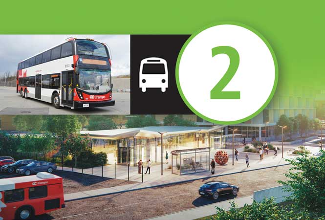
Line 2 bus
First day of Line 2 bus service: Sunday May 3, 2020

While O-Train Line 2 is closed, Line 2 bus service will operate. The Line 2 bus will serve all stations along Line 2, as well as bus stops close to the location of future stations!
The Line 2 bus will run approx. every 12 minutes on weekdays and Saturdays; and every 15 minutes on Sundays. Additional trips will be added as required and in the fall.
Where to catch the Line 2 bus
Line 2 bus route map

Click the map to enlarge.
Going to Carleton University?
You can also take these bus routes:
- Frequent Route 7
- Frequent Route 10
- Frequent Route 111
Going to Carleton University?
You can also take these bus routes:
- Frequent Route 7
- Frequent Route 10
- Frequent Route 111
Schedules
Plan your trip on the Line 2 bus using the Travel Planner or view the full route schedule (opens Travel Planner in a new tab).
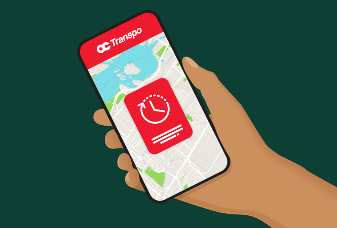
Real-time departures
For GPS-adjusted trip times:
- Use the Next Departures tool on our home page
- Text your stop number to 560560, standard rates apply
- Call 613-560-1000 and enter your stop number
- Use a mobile transit app
Real-time departures
For GPS-adjusted trip times:
- Use the Next Departures tool on our home page
- Text your stop number to 560560
- Call 613-560-1000 and enter your stop number
- Use a mobile transit app
.png)