
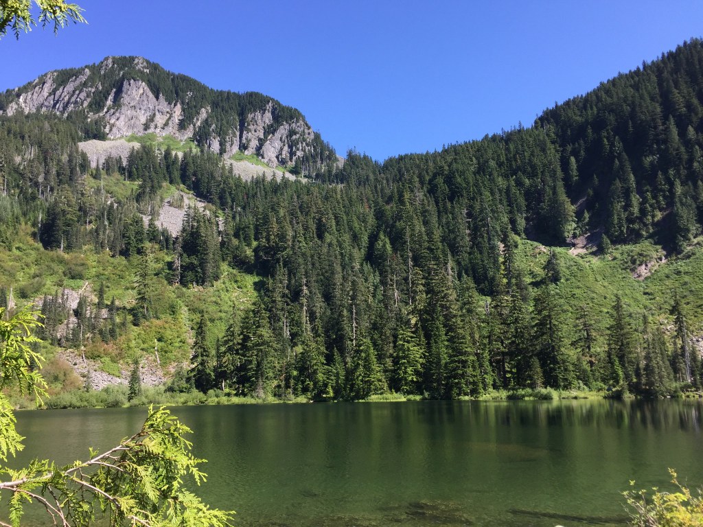

Granite Creek courses north into the Middle Fork of the Snoqualmie River, between Russian Butte to the east and Mailbox Peak to the west. The stream surges swiftly through the gorge between those mountains, and the roar of whitewater rapids dominates the valley.
Park at a spacious trailhead just south of FR 56’s concrete bridge over the Middle Fork. The trail starts southeast over a broad, graveled surface and quickly gets to work gaining the 880 feet of elevation between the trailhead and the first junction. The new trail has excellent drainage features, with many turnpikes, culverts, and drains keeping the surface dry under nearly all conditions. Pass through a forest of second-growth hemlock, alder, Douglas fir, and cedar. Ground cover includes salmonberry, thimbleberry, Cascade Oregon grape, vine maple, and sword ferns. With the heavy rain in the region, mushroomers should be on the lookout for Psilocybes and Gloeophyllum species.
Pass a log bench rest point at a switchback 0.1 miles into the hike, followed by a second log bench just past a large erratic boulder 0.6 miles into the hike. Here you can take in views of the Middle Fork valley at the second bench. The trail continues to switchback steeply upward until reaching the junction with the Granite Creek Connector 1.3 miles into the journey, at 1680 feet of elevation.
At this point, the roar of Granite Creek becomes more dominant, and you can see the rapids rushing past you, down and to the left. The grade also becomes gentler, though the trail narrows and is more prone to water cover. At 1.6 miles, there is a short spur to the left offering an overlook view of the creek, and at 1.8 miles, cross the new bridge over Granite Creek, placed by helicopter in April 2015. Remnants of the former log bridge span can be seen in the waters below you. Now on the east bank of the creek, traverse eight to ten tributary creeks in the path of the trail. These crossings are not difficult by-and-large, but the widest and deepest crossing at 2.4 miles may have ankle-deep waters. Waterproof boots and trekking poles will be helpful. Your payoff after the crossing is a 30-foot waterfall on the left.
Views of the flank of Mailbox open to the right at 2.8 miles from the trailhead. Continue your upward progress until reaching a second junction and fork in the trail, 3.5 miles from your starting point. You have reached 3070 feet of elevation, and the trail to Granite Lakes descends to your right, while the trail to Thompson Lake ascends to the left.
This hike can also be approached by starting at the Granite Creek Connector trailhead. The Washington State Department of Natural Resources (DNR) built a 1.3-mile trail segment that ascends the lower part of the Granite Creek valley between 2015-2017 and officially opened the trailhead on July 29, 2017; in doing so, DNR switched the designations of the Granite Creek and Granite Creek Connector trailheads.
The segment that ascends the upper part of the valley begins at the junction with the (new) Connector trail and follows the route of the old rail bed used by the Snoqualmie Falls Lumber Company between 1914 and the early 1940s.
WTA Pro Tip: for a more interesting hiking experience, bring a friend and park cars at both the Granite Creek and Granite Creek Connector trailheads, permitting a different route on the descent. Or allow for extra time and hike to Granite Lakes or Thompson Lake.

 Trailhead


