Mount Ellinor is the southern-most prominence on the eastern front of the Olympics. This makes its peak easy to point out to your friends when you say, ”I was up there.”
Mount Ellinor also gives you two trailheads to choose from. The lower trailhead at 2,600 feet welcomes you to the ascent with an easy grade at the outset. The route from the upper trailhead at 3,500 feet starts out with a nearly immediate upward jolt. Both routes show off the skill and diligence of the Mount Rose Trail Crew in improving and maintaining the trails.
Note that while a Northwest Forest Pass is required at the upper trailhead, hikers do not need one to access Mount Ellinor from the lower trailhead.
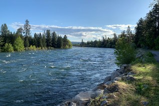
From the lower trailhead, you’ll enjoy a 6.2-mile round-trip that starts in old growth. The trail climbs with gentle switchbacks, traces the edge of a recovering clear-cut, then it flirts with a ridge edge. Several ridgeline openings-–one with benches--give broad views across Lake Cushman and far to the southeast.
From the upper trailhead, the round-trip is 3.2 miles. The more important figure to note for this route is the 2,444 feet of elevation it gains in the 1.6 miles to the summit. The track ascends a set of stacked switchbacks for 0.3 miles until it meets the lower trail.
The trails from the upper and lower trailheads merge at 3,900 feet and from there the trail continues upward at the same character-building grade of the path from the upper trailhead. More switchbacks and many with stairstep risers that add to the grade. The trail moderates briefly at the well-signed junction with the winter climbing route before heading up to the first of several panoramic viewpoints. Stopping to admire the views at each of these is a great way to catch your breath.
The trail breaks out of the trees and rises onto rock-strewn slopes and across gravelly meadows before heading through a notch and continuing upward on the west facing slopes. Take time to contemplate the new view into the southern Olympics. Just below the summit, the trail swings around to the east facing slopes. The summit area has 360-degree views and is also popular with salt-seeking mountain goats.
Mount Ellinor

-
 Length
- 6.2 miles, roundtrip
-
 Elevation Gain
- 3,300 feet
-
 Highest Point
- 5,944 feet
Mount Ellinor is the southern-most prominence on the eastern front of the Olympics. This makes its peak easy to point out to your friends when you say, ”I was up there.” Mount Ellinor also gives you two trailheads to choose from. The lower trailhead at 2,600 feet welcomes you to the ascent with an easy grade at the outset. The route from the upper trailhead at 3,500 feet starts out with a nearly immediate upward jolt. The trails merge well before the summit and continue upward at a character-building grade.
Continue reading
Hiking Mount Ellinor
Map & Directions
 Trailhead
Before You Go
Parking Pass/Entry Fee
Northwest Forest PassWTA Pro Tip: Save a copy of our directions before you leave! App-based driving directions aren't always accurate and data connections may be unreliable as you drive to the trailhead.
Getting There
In Hoodsport, leave Hwy 101 on State Route 119. Follow 119 the 9.3 miles to its end. Turn right on Forest Road 24 and follow 1.6 miles. Turn left on Forest Road 2419. You’ll reach the lower trailhead in 4.9 miles. Parking here is limited, but usually not crowded. To get to the upper trailhead, go another 1.7 miles and turn left on Forest Road 2419-014. The upper trailhead is at the end of the road. Amenities at the upper trailhead include a vault toilet, picnic table and great views.